|
 |
 |
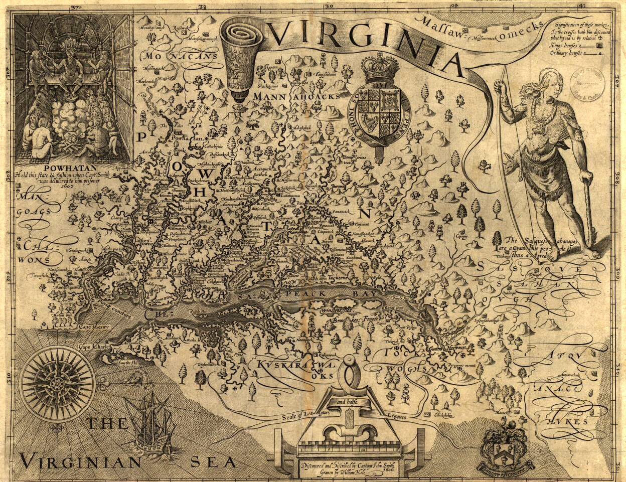
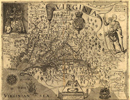
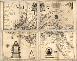
1624Map of Virginia / discovered and discribed [sic] by Captain John Smith 1606The generall historie of Virginia, New-England, and the Summer Isles; with the names of the adventurers, planters, and governours from their first beginning, ano: 1584 to this present 1624 / John Smith. London : Printed by I.D, and I.H. for Michael Sparkes, 1624. Engraved by William Hole. LOC link: Click here |
|
|
 |
|
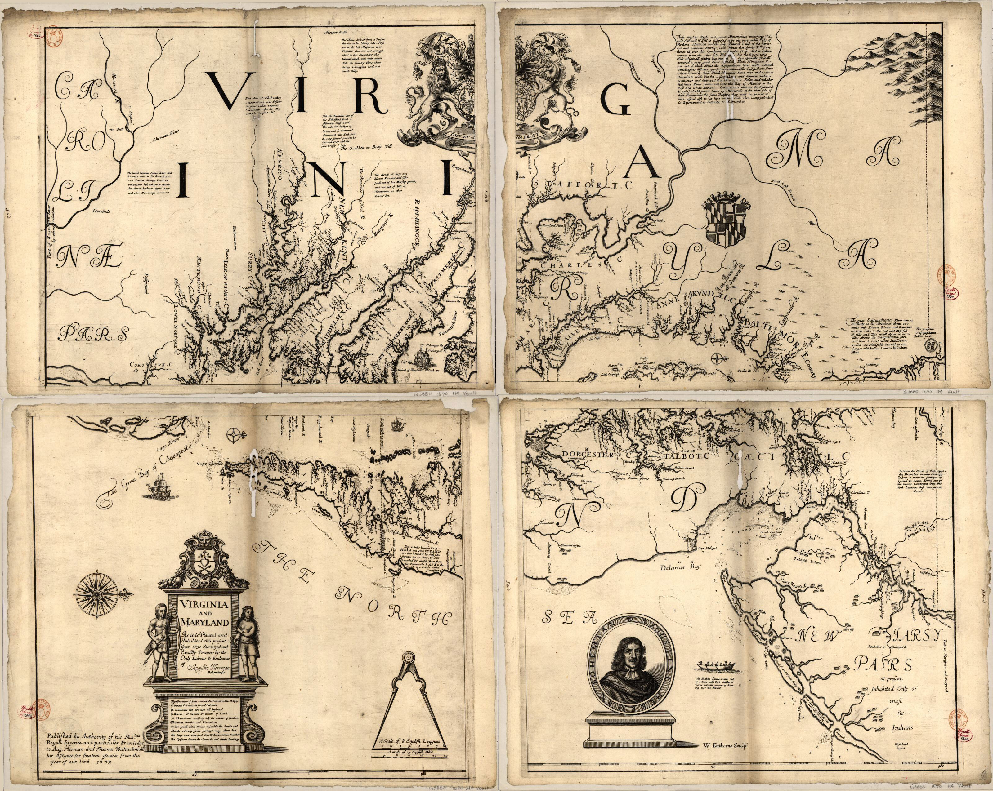
1673Virginia and Maryland as it is planted and inhabited this present year 1670London, Augustine Herrman and Thomas Withinbrook, 1673. Oriented with north to the right. LOC link: Click here |
|
|
 |
|
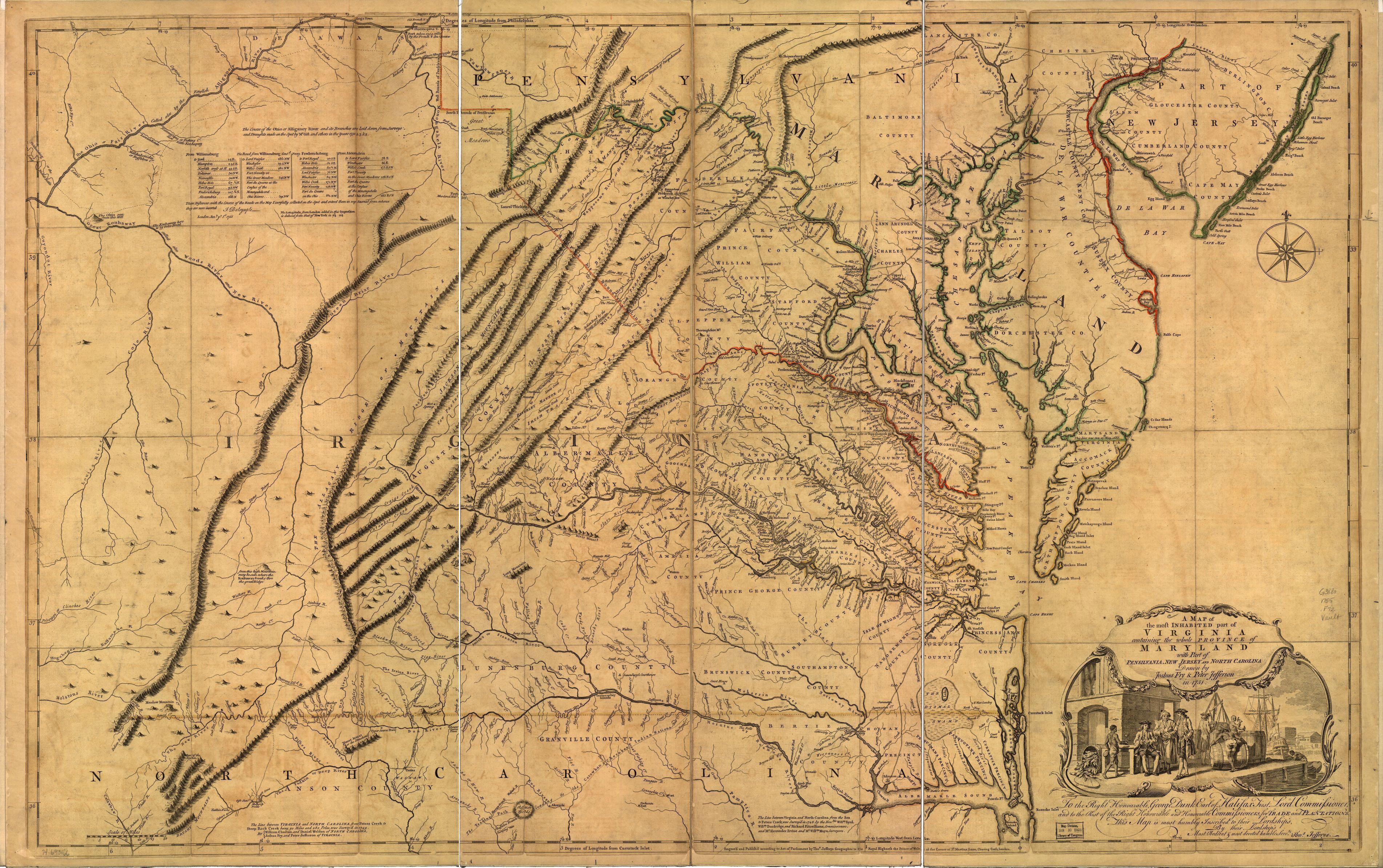
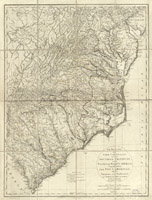
1755A map of the most inhabited part of Virginia containing the whole province of Maryland with part of Pensilvania, New Jersey and North Carolina.London, Thos. Jefferys [1755] LOC link: Click here |
|
|
 |
|
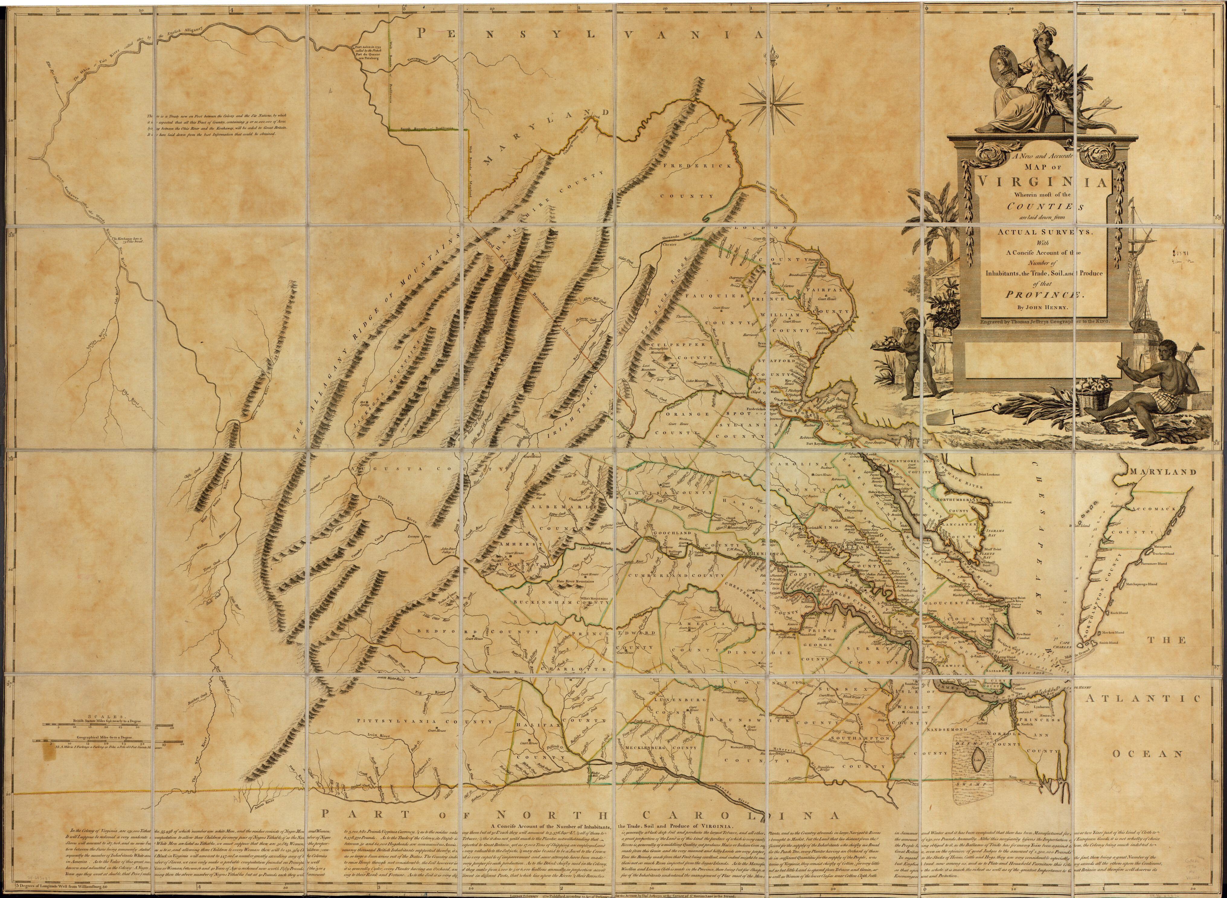
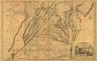
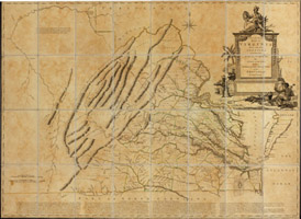
1770A new and accurate map of Virginia wherein most of the counties are laid down from actual surveys. With a concise account of the number of inhabitants, the trade, soil, and produce of that Province. By cartographer John Henry. Published in London by Thos. Jefferys, 1770 LOC link: Click here |
|
|
 |
|
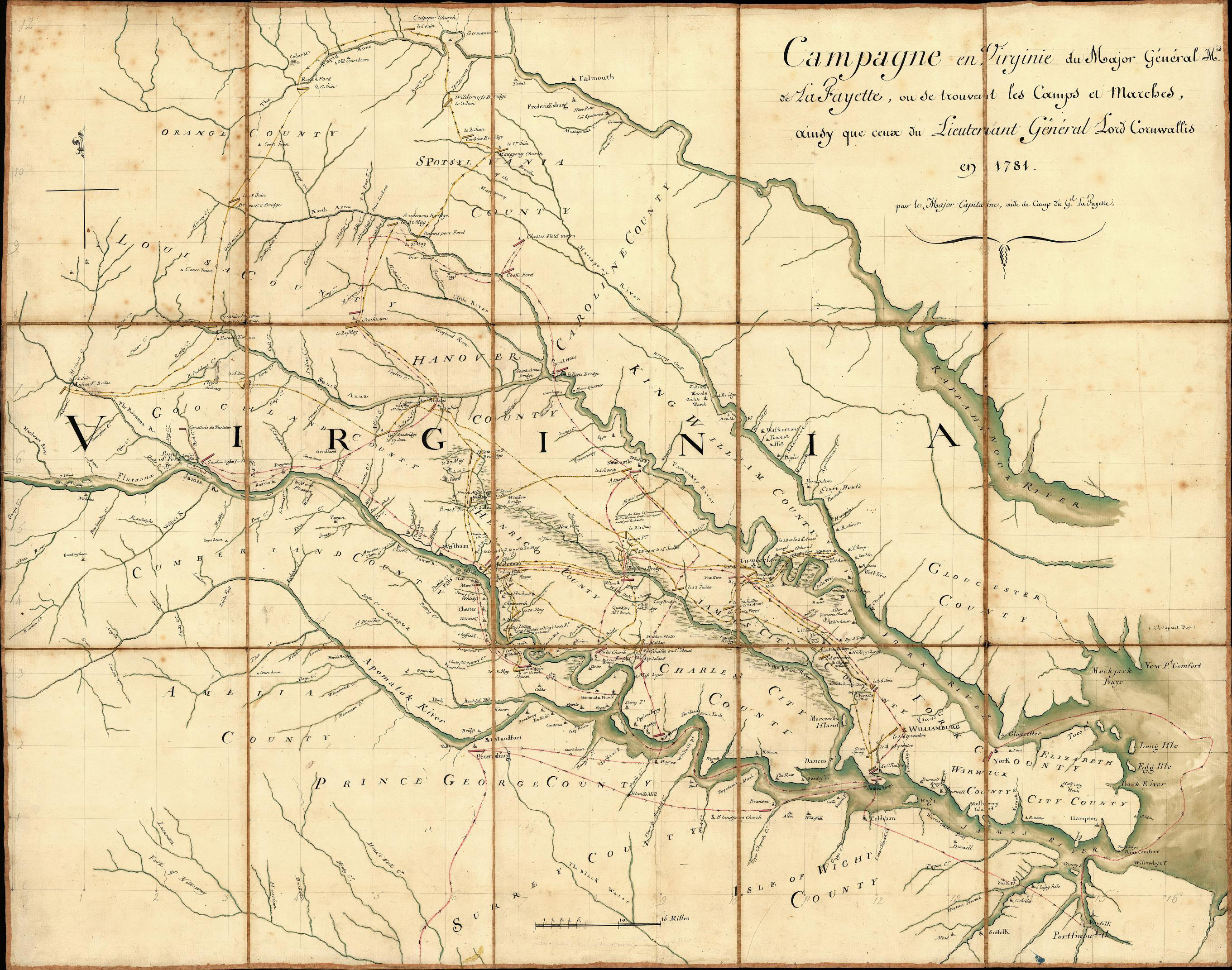
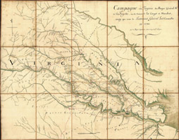
1781Campagne en Virginie du Major Général M'is de LaFayette : ou se trouvent les camps et marches, ainsy que ceux du Lieutenant Général Lord Cornwallis en 1781Covers central Virginia from Orange County in the north to Isle of Wight County in the south, and west to Cumberland County. Shows selected bridges, houses, churches, taverns, and other points of interest, and includes notes describing dates of military actions in the Yorktown campaign. Sectioned to 15 panels and mounted on cloth backing to fold to ca. 29 x 22 cm. LOC link: Click here |
|
|
 |
|
1781-1782Revolutionary War Road and Transportation Survey in Commonwealth of Virginia, 1781 - 1782This is a series of maps based on those made by Washington and Rochambeau detailing the route they took through Virginia in 1781-1782, which relates their route to modern maps. The link below calls up the chapter of Robert A. Selig's book, Revolutionary War Road and Transportation Survey in Commonwealth of Virginia, 1781 - 1782, with the map details. PDF link: Click here |
|
|
 |
|
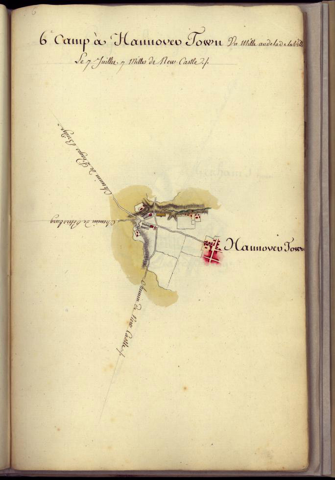
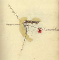
1782Amérique CampagneA compendium of manuscript maps, in pen-and-ink and watercolor, created in 1782, at the end of the Revolutionary War. The maps show the location of the camps of the army of the Comte de Rochambeau, during its march north from Williamsburg, Virginia, to Boston between July and December, 1782. Pictured here is the camp at Hannover Town.LOC link: Click here |
|
|
 |
|
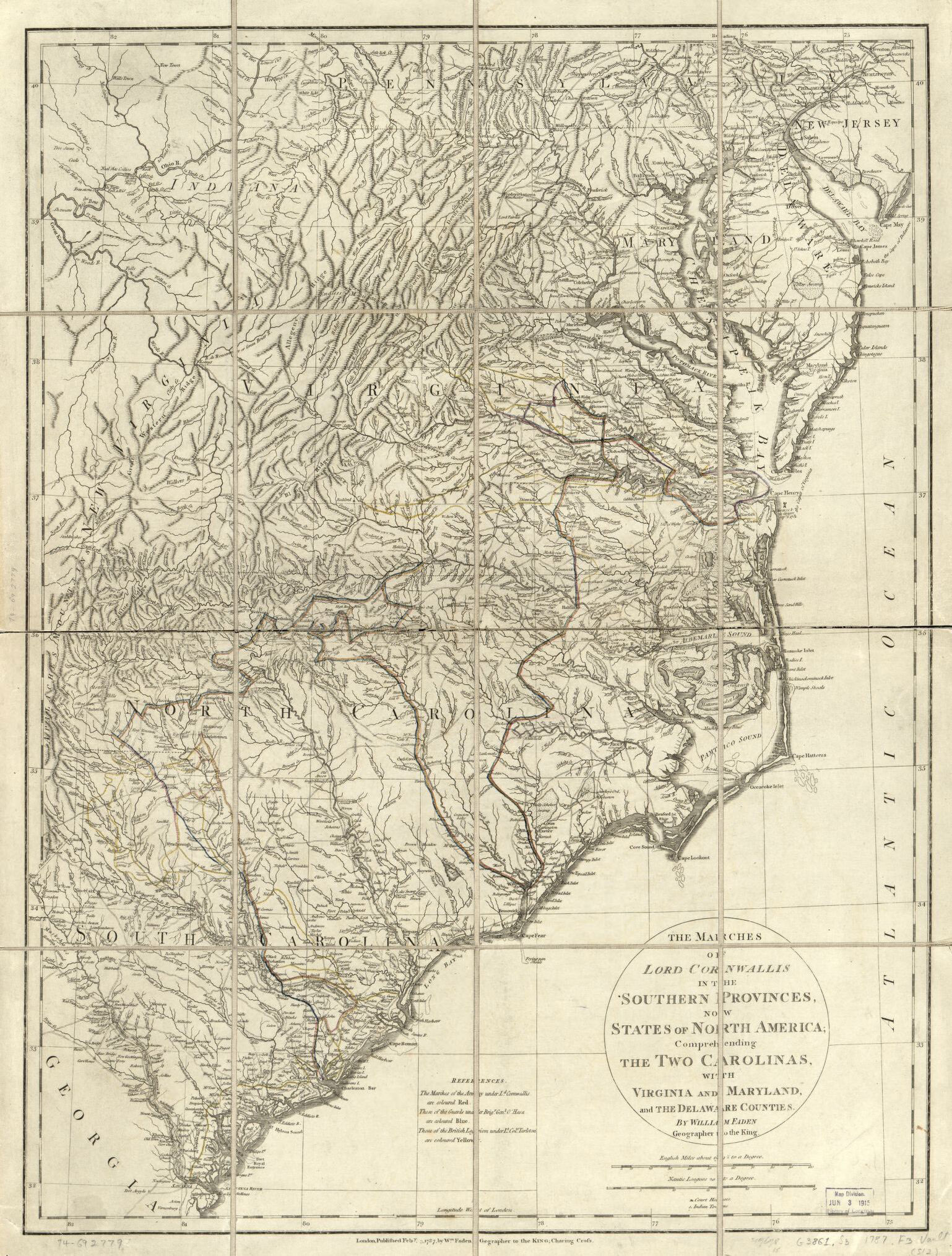
1787The marches of Lord Cornwallis in the Southern Provinces, now States of North America; comprehending the two Carolinas, with Virginia and Maryland, and the Delaware countiesThe marches of the army under Ld. Cornwallis are coloured red. Those of the guard under Brigr. Genl. O'Hara are coloured blue. Those of the British legion under Lt. Coll. Tarleton are coloured yellow. LOC link: Click here |
|
|
 |
|
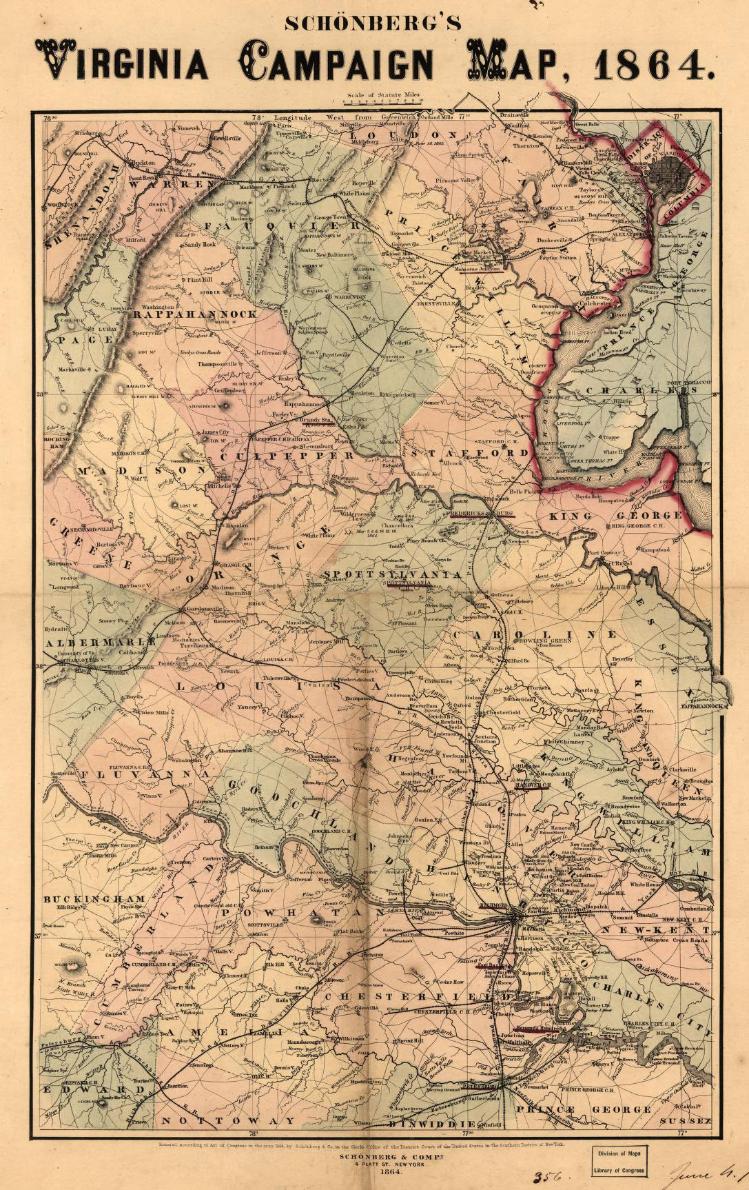
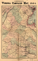
1864Schönberg's Virginia Campaign MapMap extends from Ashby's Gap south to Winfield and Charlottesville east to Tappahannock and shows the location and date of engagements, towns, roads, railroads, county names and boundaries, drainage, and some relief by hachures. A few place names are underlined in red. LOC link: Click here |
|
|
 |
|
1862/1864
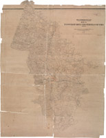
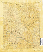
Gilmer's Map of Hanover, Henrico and Chesterfield Counties
Jeremy Francis Gilmer was the Chief of Engineers for the Confederate Army during the US Civil War. In addition to his other duties, Gilmer and his crew created many exquisite maps in support of the Confederacy, 64 of which were saved from Richmond's Evacuation Fire of 1865.
Click the thumbnail to the left to see the full-sized map! |
|
|
 |
|
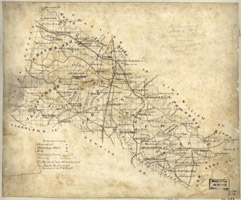
1871Preliminary map of Hanover County, Virginia By cartographer Jedediah Hotchkiss. LOC link: Click here |
|
|
 |
|
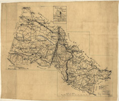
1886Map of Hanover County, Virginia By cartographer Jedediah Hotchkiss. LOC link: Click here |
|
|
 |
|
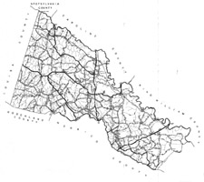
1932Map of Hanover County, Showing State and County Roads From the Commonwealth of Virginia Department of Highways. Click here to download the PDF file. |
|
|
 |
|
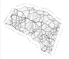
1932Map of Louisa County, Showing State and County Roads From the Commonwealth of Virginia Department of Highways. Click here to download the PDF file. |
|
|
 |
|
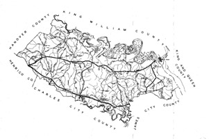
1932Map of New Kent County, Showing State and County Roads From the Commonwealth of Virginia Department of Highways. Click here to download the PDF file. |
|
|
The University of Texas has a collection of the earliest topographical maps that cover Hanover County, which they are kind enough to present online.
Below are a few of interest, but their whole list of Virginial Historical Topographical Maps can be found here.
|
|
 |
|
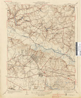
1892Virginia: Goochland SheetU.S. Geological Survey, surveyed in 1888. Includes Goochland County and parts of Hanover, Louisa, Caroline, Henrico, Powhatan and Chesterfield Counties. Utexas.edu link: Click here |
|
|
 |
|
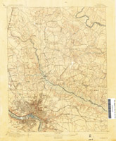
1892Virginia: Richmond SheetSurveyed 1889-1892. Includes Richmond, Mechanicsville, Studley, French Hay and parts of Henrico and Hanover Counties. Utexas.edu link: Click here |
|
|
 |
|
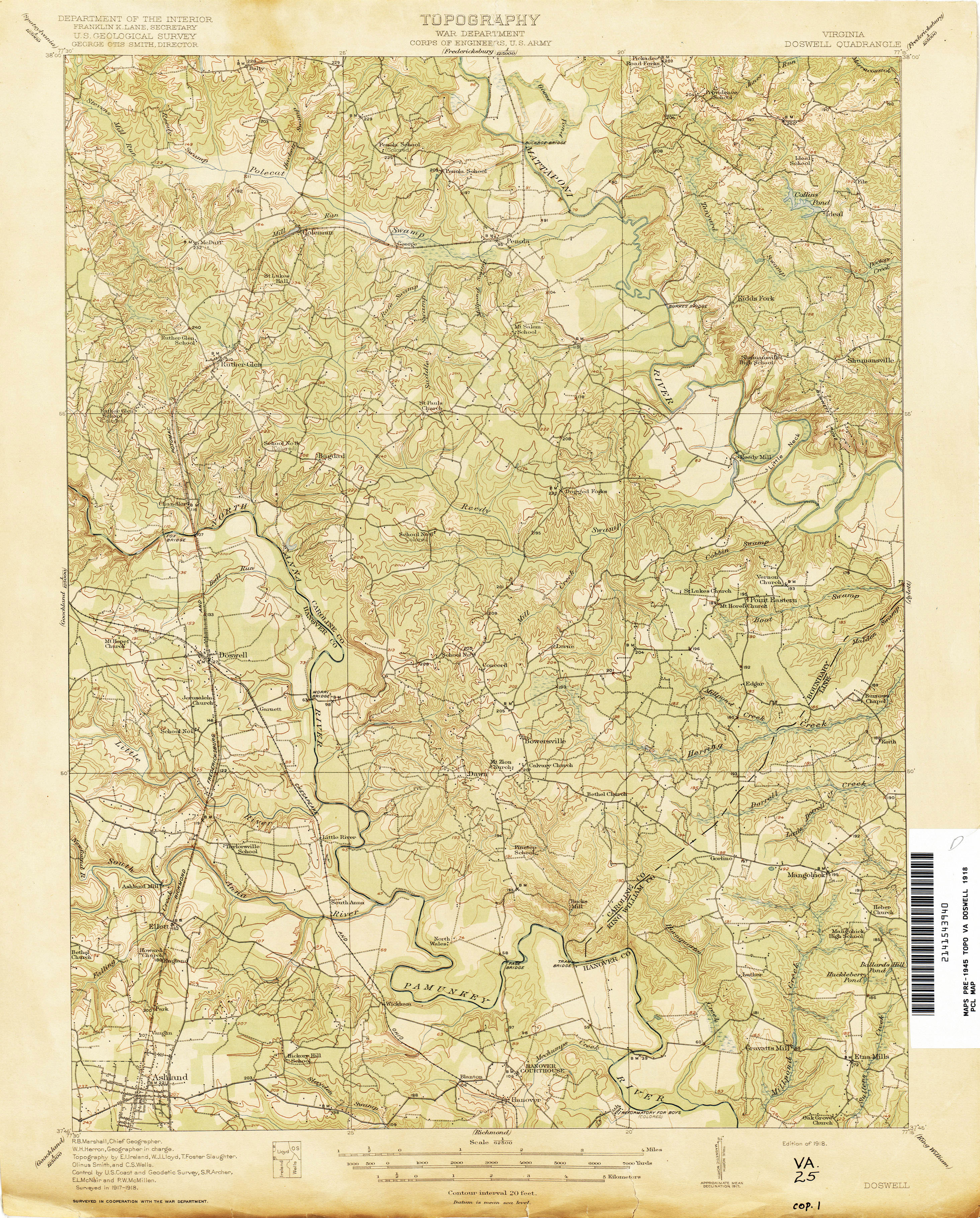
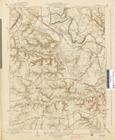
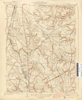
1918Virginia Doswell QuandrangleSurveyed 1917-1918. Includes Doswell, Ashland, Hanover Courthouse and parts of Hanover, King William and Caroline Counties. Utexas.edu link: Click here |
|
|
 |
|
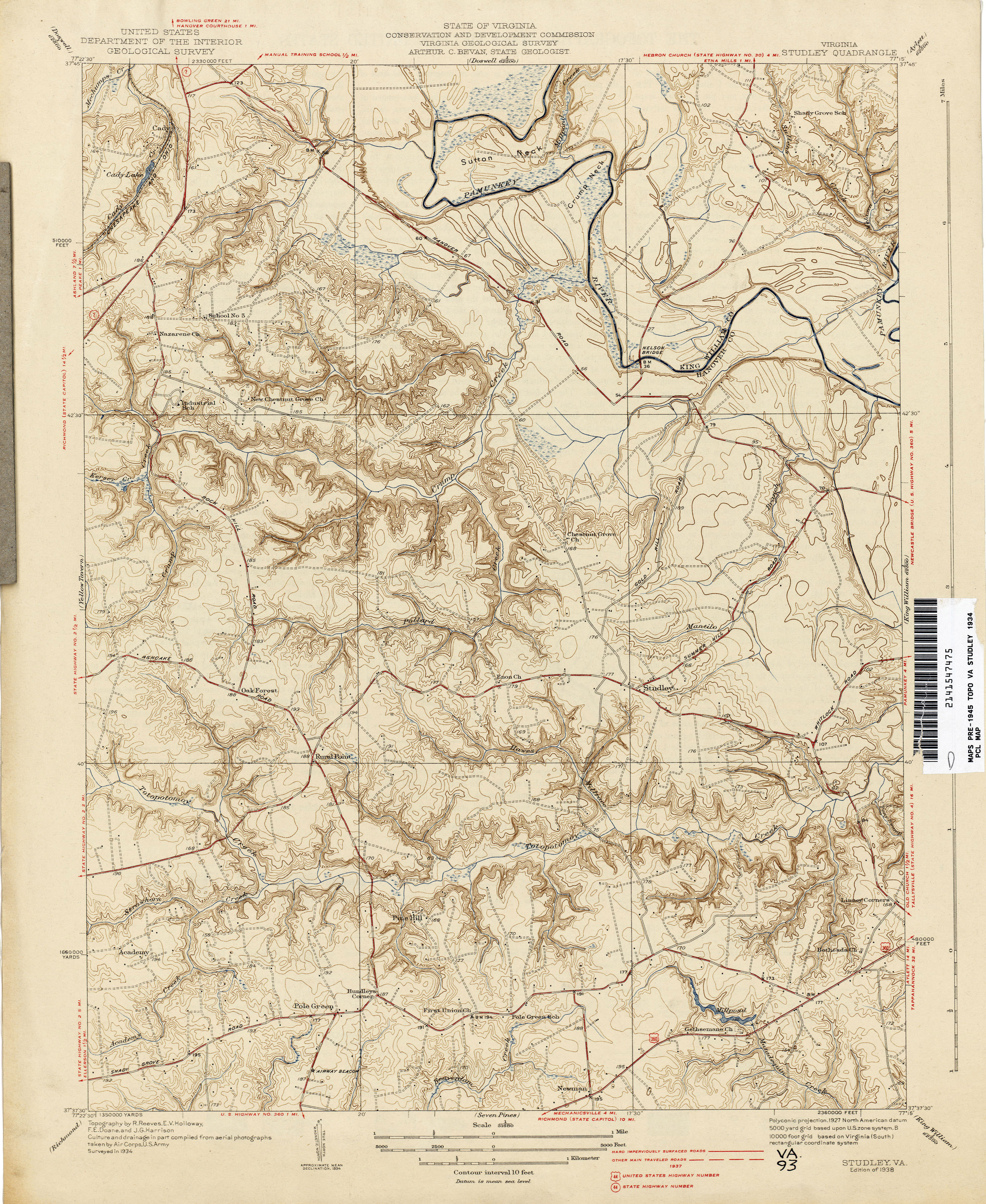
1934Virginia Studley QuandrangleCulture and drainage in part compiled from aerial photographs taken by Air Corps, US Army. Includes Studley, Rural Point, Pole Green and part of King William County. Utexas.edu link: Click here |
|
|
 |
|
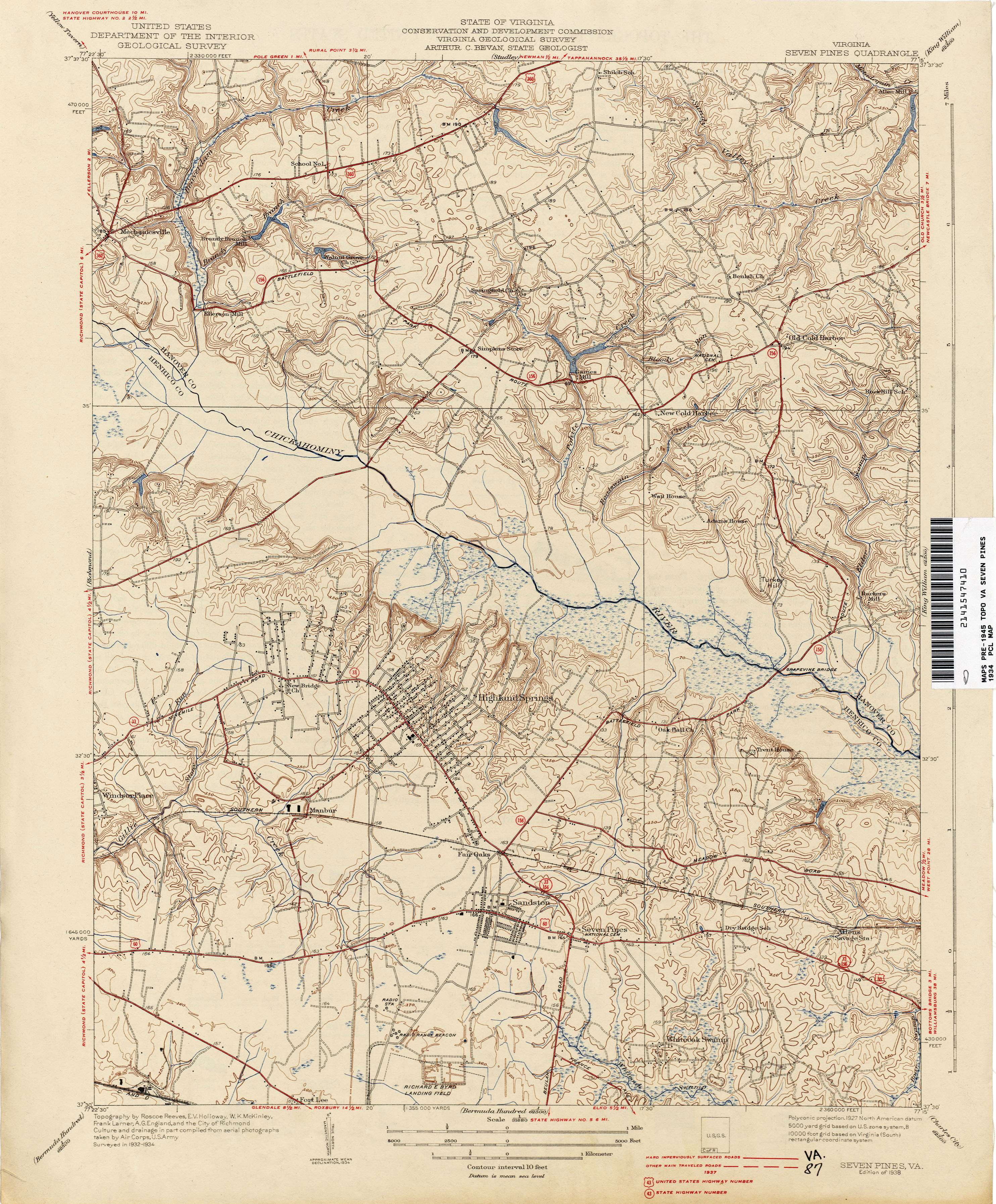
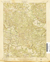
1938Virginia Seven Pines QuandrangleSurveyed 1932-1934. Includes Mechanicsville, Cold Harbor and Walnut Grove, plus parts of Hanover and Henrico Counties. Utexas.edu link: Click here |
|
|
 |
|
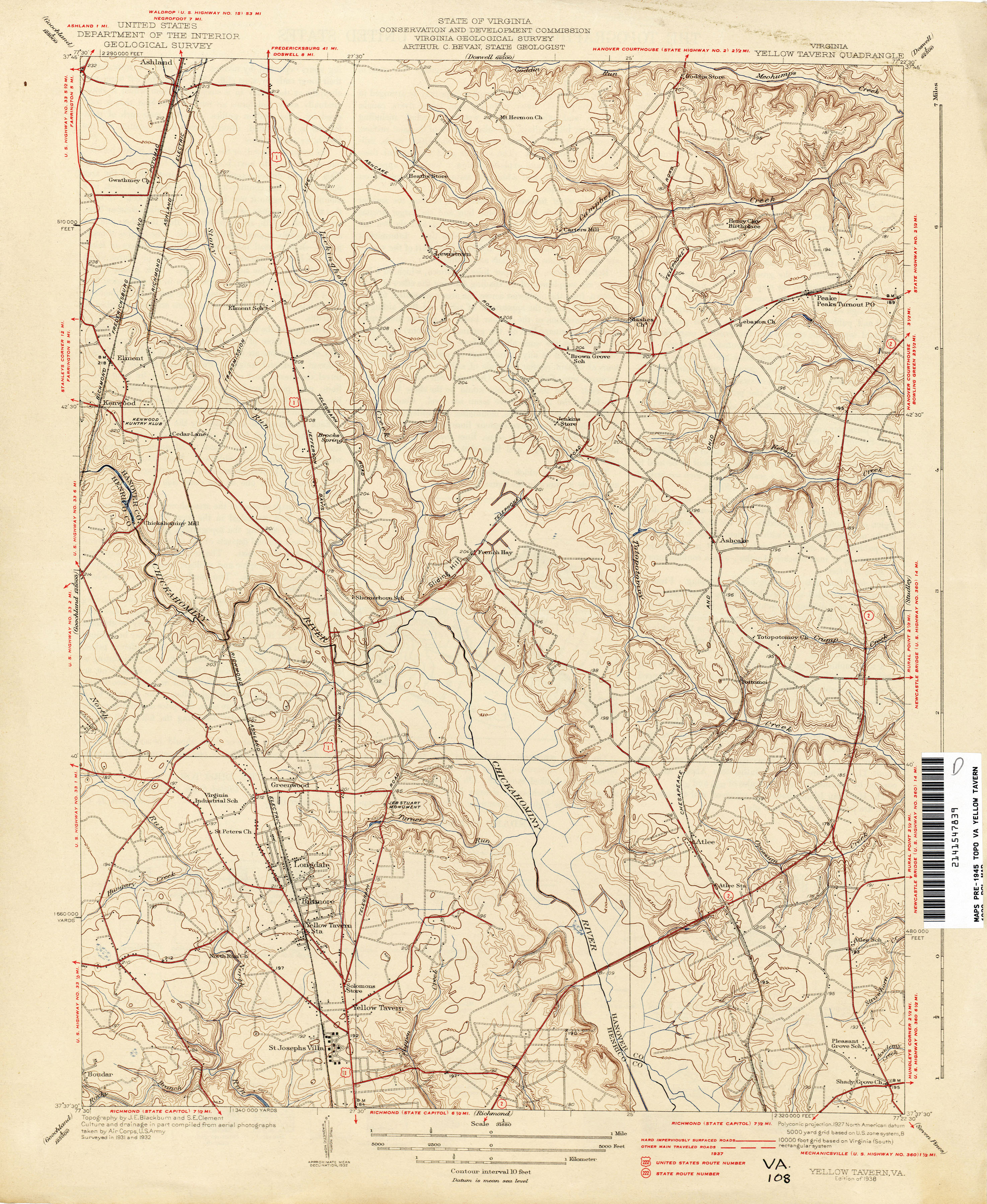
1932Virginia Yellow Tavern QuandrangleSurveyed 1931-1932. Includes Slash Church, Henry Clay's birthplace and part of Henrico County. Utexas.edu link: Click here |
|
|